
For too long, the fight against systemic corruption within child protection agencies has been fought in isolation. Individual parents, activists, and whistleblowers often find themselves battling a massive, state-funded machine without a roadmap. But there is a shift happening.
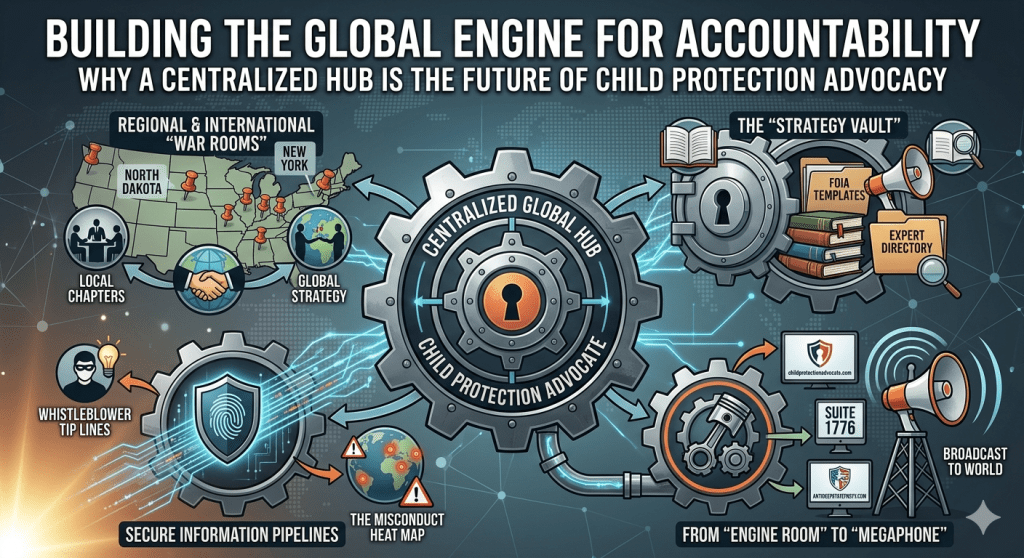
The missing link in many grassroots movements is a centralized global hub. When activists from different regions—from North Dakota to New York, and from the United States to Europe—can compare notes, the “isolated incidents” reported by agencies begin to look like what they truly are: systemic patterns. At childprotectionadvocate.com, we are building the digital “Engine Room” for this movement. Here is how we are structuring our platform to turn global outrage into collective action.
1. Regional & International “War Rooms”
The law is local, but the struggle is global. Because regulations vary wildly between jurisdictions, our platform utilizes specialized sub-groups:
- Local Chapters: Dedicated spaces for state-specific laws and local action. Whether it’s organizing courtroom observations in your home county or protesting a specific regional office, these chapters allow for boots-on-the-ground coordination.
- Global Strategy: A high-level forum for sharing information on international treaties and identifying common tactics used by corrupt agencies across borders. When we see the same patterns repeating in different countries, we can develop better countermeasures.
2. The “Strategy Vault”
Advocacy requires more than just sharing stories; it requires tools. Our Strategy Vault is a dedicated section for actionable resources, including:
- Template Library: Ready-to-use FOIA (Freedom of Information Act) request templates, scripts for calling legislators, and “Know Your Rights” handbooks designed specifically for parents navigating the system.
- Expert Directory: Access to a vetted network of attorneys, psychologists, and investigative journalists who specialize in these complex cases and understand the nuances of the system.
3. Secure Information Pipelines
Real change often starts with the truth that agencies want to keep hidden. We are establishing secure channels for information sharing:
- Whistleblower Tip Lines: Providing a secure, anonymous way for employees within these agencies to share data and evidence of misconduct without risking their livelihoods.
- The Misconduct Heat Map: By aggregating reports of atrocities and categorizing them by location, we are building a visual data set that exposes where the most frequent abuses are occurring.
4. From the “Engine Room” to the “Megaphone”
Our ecosystem is built for maximum impact. While childprotectionadvocate.com serves as the Engine Room—the place where we organize, verify, and strategize—our partner platforms like Studio1776.com Suite1776.com and AntiDeepStateParty.com serve as the Megaphone.
This integration ensures that the information gathered by our community doesn’t just sit on a server; it is broadcast to the world through independent media, reaching the public and the policymakers who need to see it most.
Join the Movement
The system relies on our silence and our isolation. By bringing the world’s activists into one location, we are ending that isolation and building a force for accountability that cannot be ignored.
Visit [childprotectionadvocate.com] today to join the fight.
#Watchdog
#GovernmentAccountability
#EndSystemicAbuse
#CPSReform
#FamilyCourtCorruption
#ExposeTheTruth
#TransparencyNow
#Whistleblower
#HoldThemAccountable
Category 2: Broad Child Protection & Children’s Rights
Use these to reach the widest audience interested in the ethical imperative of protecting children and supporting the ” collective effort.”
#ChildProtection
#ChildrensRights
#ProtectOurChildren
#SaveTheChildren
#ChildWelfare
#EndChildAbuse
#SpeakUpForChildren
#SafeguardingChildren
#NoMoreSilence
Category 3: Foster Care & Family Advocacy
Use these to connect directly with the communities most affected—foster parents, adoptees, biological parents, and people searching for actionable resources (“Strategy Vault”).
#FosterCareAdvocate
#FosterCareReform
#VoicesOfFosterCare
#FosterParentSupport
#BiologicalParentsRights
#FamilyPreservation
#KnowYourRights
#FosterYouthVoice
#AdoptionReform
Category 4: Movement Building & Digital Activism
Use these to link your posts to the larger ecosystem of social change and coordinate collective action (“Megaphone”).
#Activism
#GrassrootsMovement
#SocialJustice
#CommunityOrganizing
#CollectiveAction
#HumanRights
#DigitalAdvocacy
#ChangeIsComing
#PowerToThePeople
