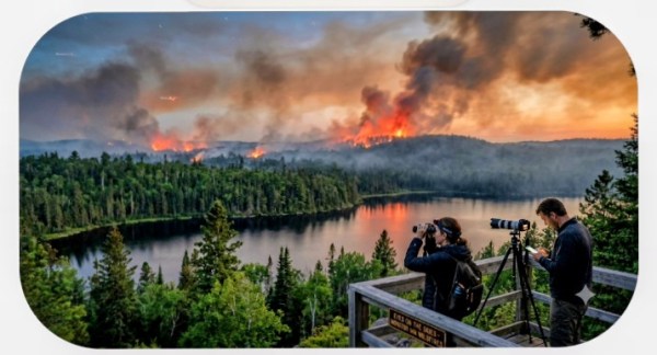
When we think of wildfires, we usually picture a combination of dry lightning, extreme heat, and climate-fueled droughts. But across the globe, a far more sinister force is driving some of the world’s most devastating blazes: **deliberate destruction for profit.**
As of today, **July 17, 2026**, there is intense wildfire activity across the United States, with **68 large active fires** burning roughly **638,070 acres** across 15 states. Firefighters are facing mid-August conditions early due to severe drought, extreme heat domes, and recent massive lightning storms.
The situation is split between massive blazes in the West and Midwest, coupled with widespread hazardous air quality affecting millions of Americans.
## 1. Hotspots by Region
### The Pacific Northwest & West
A prolonged period of dry lightning has caused a massive surge of new fires in this region.
* **Oregon & Washington:** Oregon is currently managing the highest volume of major blazes with **19 active large fires**. Tens of thousands of lightning strikes earlier this week sparked dozens of new starts across both states.
* **Colorado & Utah:** Highly destructive fires continue to burn here. Large incidents like the *Aspen Acres Fire* (nearly 100,000 acres in Colorado) and the *Babylon Fire* (over 107,000 acres in Utah) are keeping thousands of personnel deployed.
### The Midwest (Minnesota)
* **Boundary Waters Fires:** In northeastern Minnesota, the **Superior National Forest** is experiencing extreme fire behavior. About 17 lightning-caused fires exploded this week, forcing the complete evacuation and closure of the **Boundary Waters Canoe Area Wilderness**. Forest rangers have been canoeing and motorboating through waterways to safely evacuate an estimated 6,000 to 10,000 campers. Major uncontained blazes here include the *Bear Trap Fire* (34,422 acres) and the *Thumb Fire* (15,394 acres).
## 2. Smoke and Air Quality Crisis
The combination of out-of-control fires in Western Ontario (Canada) and Northern Minnesota has funneled a thick, dangerous blanket of smoke southward and eastward.
* **Cities Affected:** Over 109 million Americans are under air quality alerts today. **Detroit, Chicago, Baltimore, and Washington, D.C.** have topped charts for the worst air quality of major world cities. Air Quality Index (AQI) levels hit “hazardous” territory in Detroit (peaking past 700) and reached highly toxic “Code Purple/Red” levels across the Mid-Atlantic today.
* **Weather Relief Timeline:** A strong storm system moving from the west is expected to bring heavy rain to the Midwest and East Coast late Saturday. This should wash a significant amount of particulate matter out of the air, offering noticeable breathing relief by Sunday afternoon.
If you are downwind of these plumes, health officials strongly advise keeping windows shut, running central air on a high-efficiency filter (MERV-13 or higher), and utilizing an N95 mask if you must go outdoors. You can track real-time localized smoke conditions at **Fire.airnow.gov**.
What happens when wildfires aren’t an accident of nature, but a calculated weapon?
This tactic—often referred to as **land-grab arson**—is a devastating method used by corrupt developers, corporate speculators, and sometimes state-backed actors to force communities off their land and seize their natural resources. Here is a look inside the dark world of manufacturing disasters for profit.
## 1. The Mechanics of Land-Grab Arson
The playbook for land-grab arson is as simple as it is brutal:
* **The Target:** Indigenous groups, smallholder farmers, or traditional communities who hold valuable, resource-rich land but lack formalized or heavily defended legal titles.
* **The Ignition:** Perpetrators intentionally set fires during the dry season. The goal is to destroy homes, wipe out livestock, and ruin agricultural soil in a single swoop.
* **The Displacement:** Left with nothing but ash, the community is forced to flee the area for basic survival.
* **The Seizure:** With the community gone, speculators swoop in to claim the “abandoned” territory, often using forged paperwork to clear the way for cattle ranching, mega-farms, or mining operations.
## 2. *Grilagem*: The Amazon’s Forest-Clearing Weapon
Nowhere is this crisis more visible than in the Amazon rainforest, where the practice is deeply institutionalized under the name ***grilagem*** (land grabbing).
In Brazil, professional land grabbers (*grileiros*) view standing forests as an economic roadblock. Because cutting down massive trees by hand is slow and expensive, they use fire as a cheap, rapid bulldozing tool. By burning out indigenous territories and public forests, they instantly clear thousands of acres. Once the smoke clears, they forge land deeds, plant pasture grass, and sell the stolen land to large-scale agricultural operations.
## 3. Disaster Capitalism and “Eco-Displacement”
Sometimes, the theft doesn’t happen during the fire, but in the immediate aftermath. This falls under a concept known as **disaster capitalism**—exploiting a crisis to push through policies that would have been impossible during normal times.
When a manufactured or natural fire tears through a community, governments or corporate interests may declare the zone “environmentally unstable” or “too high-risk” for residents to return. Under the guise of public safety or environmental conservation, locals are permanently barred from rebuilding. Years later, those same strict zoning laws are quietly lifted or bypassed, opening the door for luxury eco-tourism, private real estate, or industrial resource extraction.
## 4. Urban Arson-for-Profit
This tactic isn’t strictly limited to remote jungles or rural valleys. A localized version exists in urban planning, often called **arson-for-profit** or **gentrification by fire**.
In high-value metropolitan areas, landlords or developers looking to cash in on skyrocketing real estate prices have historically used arson to clear out rent-controlled buildings or low-income neighborhoods. By making the property unlivable, they force out tenants, bypass lengthy eviction courts, collect insurance payouts, and clear the land for profitable luxury developments.
> ### The Bottom Line
> Fire is being used as a weapon of displacement because it leaves behind a blank slate. It destroys evidence, erases physical community history, and forces immediate evacuation.
> Recognizing **land-grab arson** for what it is—corporate warfare and violent theft, rather than a natural disaster—is the first step toward creating international legal frameworks that protect vulnerable communities from being burned out of their homes.
>Here is an additional section you can help our readers dig deeper into the identity of the aircraft they are tracking.
### **How to Identify the “Invisible” Owners**
Seeing a plane on a map is only the first step. To truly hold these operations accountable, we need to know who is behind the controls. Most aircraft in the U.S. carry a “license plate” known as an **N-Number** (or tail number).
#### **1. The FAA Registry (The Primary Source)**
Every aircraft registered in the United States is listed in the **FAA Aircraft Registration Inquiry** database.
* **How to search:** Go to registry.faa.gov.
* **The Pro-Tip:** When searching, **do not include the ‘N’**. If the tail number is N12345, just type “12345.”
* **What you’ll find:** This will give you the name of the registered owner, their address, and the specific type of aircraft.
#### **2. Peeling Back Corporate Layers**
Often, suspicious planes are registered to an LLC (Limited Liability Company) or a “Trust” to hide the true owner. If the FAA shows a name like *”Alpha-Bravo Holdings LLC,”* don’t stop there:
* **Secretary of State Search:** Go to the Secretary of State website for the state listed in the FAA address. Search for that LLC name to see who the “Registered Agent” or “Manager” is.
* **OpenCorporates:** Use OpenCorporates.com to see if that company is linked to other businesses or individuals.
#### **3. Tracking “Blocked” Aircraft**
Some owners pay to have their tail numbers hidden from popular sites like FlightRadar24. This is a red flag for watchdogs.
* **Use ADS-B Exchange:** This site is community-run and **does not filter out blocked aircraft**. If a plane is invisible on other apps, it will often still show up here.
* **Check the Serial Number:** If you can’t find the tail number but have the “Hex Code” (a series of letters and numbers from the tracking site), you can often trace that back to the original registration.
#### **4. Identifying Flight Schools & Contractors**
If the owner is listed as **UND Aerospace** or a private contractor like **Dynamic Aviation** or **Bridger Aerospace**, take note of the duration they spend over fire zones. Are they performing standard maneuvers, or are they loitering in ways that don’t match official firefighting procedures?
### **Important Safety Note for Watchdogs**
* **Stay Legal:** All of this information is **public record**. You have every right to access it and share it.
* **Stay Focused:** The goal is transparency. Focus on documenting the *facts*: times, tail numbers, and coordinates. The more precise our data, the harder it is for them to ignore us.
Official Watchdog Resources:
- MNICS.org: The home of the Minnesota Incident Command System for coordination and updates.
- InciWeb: For official status reports on active, major federal incidents.
- DNR Fire Danger Rating Map: For real-time updates on color-coded danger zones.
- NASA FIRMS Map: For satellite-detected hotspots.
**The land is burning.** From the plains of Kansas and Iowa to the forests of North Dakota and Minnesota, our communities—and our national food supply—are under threat. But while the smoke rises, something else is happening in the air.
Many of us have noticed unusual flight patterns over sensitive areas like the **White Earth** and **Leech Lake** Reservations. When private university planes and “untraceable” aircraft circle active fire zones under the cover of darkness, we have a right to ask: **Why?**
If we want to protect our land and our future, we need a community of watchdogs. We aren’t just bystanders; we are witnesses. Here is how you can help monitor the situation and document what’s happening in real-time.
### **1. Track the Patterns in Real-Time**
You don’t need a radar dish to see what’s flying overhead. Use these open-source tools to identify aircraft:
* **FlightRadar24:** The gold standard for real-time tracking. Use the “Playback” feature to go back in time and see if flight records are being altered or removed.
* **ADS-B Exchange:** Unlike other sites, ADS-B Exchange does not filter out “blocked” or private aircraft. If a plane is trying to fly “dark,” this is often where you can still find it.
* **Look for “Grid” Patterns:** Official survey and firefighting planes fly in specific back-and-forth “mowing the lawn” patterns. Anything that deviates from this—or circles aimlessly over hotspots—needs to be documented.
### **2. Match the Fire to the Flight**
To see if planes are targeting specific areas, overlay flight data with live fire maps:
* **NASA FIRMS (Fire Information for Resource Management System):** This tool shows satellite-detected “hotspots” within 3 hours of observation.
* **InciWeb:** Check the official status of fires. If a plane is circling a “new” fire that hasn’t been reported on InciWeb yet, that is a red flag.
### **3. Document Everything**
A screenshot is worth a thousand words. If you see something suspicious:
* **Capture the Tail Number (N-Number):** If available, this is the aircraft’s “license plate.”
* **Note the Altitude:** Most firefighting or legitimate surveillance happens at specific, regulated altitudes.
* **Log the Time and Location:** Be precise about which reservation or town the activity is over.
### **4. Why This Matters**
When institutions like **UND Aerospace** or private contractors operate over sensitive areas, there should be full transparency. Our food supply and our indigenous lands are too important to leave to “untraceable” maneuvers.
**Knowledge is our best defense.** When we all watch together, it becomes much harder for things to happen “under cover of darkness.”
### **CALL TO ACTION**
Are you seeing strange flight paths over your area tonight? **Post your screenshots in the comments or share them with the hashtag #EyesOnTheSkies.** **Stay alert. Stay loud. Protect the land.**
### **Watchdog Resources:**
* FlightRadar24
* ADS-B Exchange
* NASA FIRMS Map
We have added a section specifically about how to research the owners of the private planes once a tail number is identified.
#EyesOnTheSkies, #LandGrabArson, #WhiteEarth, #LeechLake, #Watchdog, #FlightTracking, #ADSBExchange, #ArsonForProfit, #DisasterCapitalism, #ProtectTheLand, #StayAlert, #StayLoud, #Transparency, #CitizenJournalism, #TruthSeeker, #Studio1776


